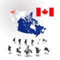
map newfoundland and labrador flag provinces territories canada vector illustration

navigate by keyword : and area arms atlas background banner border canada canadian cartography city coat color contour country culture cut design direction district division election flag flat geographic geography graphic icon illustration image isolated johns labrador land leaf map maple nation national newfoundland out outline patriotism province road shape sign silhouette state symbol travel unity vector white

Map of Newfoundland and Labrador. Flag of Newfoundland and Labrador. Provinces and territories of Canada. Vector illustration Royalty Free Stock Photo
Canada map with flags of provinces and territories. Vector illustration Royalty Free Stock Photo
Newfoundland and Labrador Map on Canadian Flag. NL, CA Province Map on Canada Flag. EPS Vector Graphic Clipart Icon Royalty Free Stock Photo
Vector set. Map of Canada with provinces and territories flags. Royalty Free Stock Photo
Vector set. Map of Canada with provinces and territories flags Royalty Free Stock Photo
   
   
Map of Newfoundland and Labrador. Flag of Newfoundland and Labrador. Provinces and territories of Canada. Vector illustration
Full Canada Vector Map of Provinces, Territories and Capitals in bright colors. Royalty Free Stock Photo
Flags of Canadians provinces and territories. Vector illustration Royalty Free Stock Photo
Map of Canada with rivers and lakes. Royalty Free Stock Photo
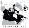
Canada Map and and Flat Map Pointers isolated on white Royalty Free Stock Photo
Set of canada provinces and territories icons Royalty Free Stock Photo
Canada map with provinces and boundary Royalty Free Stock Photo
Canada Vector colored map of provinces and capital cities for north american concepts Royalty Free Stock Photo
Map of Newfoundland and Labrador. Flag of Newfoundland and Labrador. Provinces and territories of Canada. Vector illustration.


Stockphotos.ro (c) 2025. All stock photos are provided by Dreamstime and are copyrighted by their respective owners.