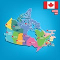
canada map with flags provinces and territories vector illustration

navigate by keyword : alberta america background banner british brunswick button canada canadian cartography collection colors columbia country edward emblem federal flag flags illustration island labrador manitoba map maple national new newfoundland northwest nova nunavut ontario prince province provinces provincial quebec saskatchewan scotia set shape state stripes symbol territories territory vector yukon

Canada map with flags of provinces and territories. Vector illustration Royalty Free Stock Photo
Vector set. Map of Canada with provinces and territories flags. Royalty Free Stock Photo
Flags of Canadians provinces and territories. Vector illustration Royalty Free Stock Photo
Vector set. Map of Canada with provinces and territories flags Royalty Free Stock Photo
Map of Saskatchewan. Flag of Saskatchewan. Provinces and territories of Canada. Vector illustration Royalty Free Stock Photo
   
Print Royalty Free Stock Photo
Canada map with flags of provinces and territories. Vector illustration
Map of Nunavut. Flag of Nunavut. Provinces and territories of Canada. Vector illustration Royalty Free Stock Photo
Set of canada provinces and territories icons Royalty Free Stock Photo
Map of yukon, canada Royalty Free Stock Photo
Map of nunavut, canada Royalty Free Stock Photo
canada map. Vector illustration decorative design Royalty Free Stock Photo
Map of North America with Country Flags Illustration Royalty Free Stock Photo
Map of northwest territories, canada Royalty Free Stock Photo
Canada map with flags of provinces and territories. Vector illustration. Ottawa, Toronto, Vancouver


Stockphotos.ro (c) 2025. All stock photos are provided by Dreamstime and are copyrighted by their respective owners.