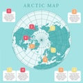
arctic map with countries boundary grid and label regions northern hemisphere circumpolar projection vector infogra

navigate by keyword : background consulting debbugging expert expertise map procedural programming rules technology worl

Arctic map with countries boundary, grid and label. Arctic regions of northern hemisphere. Circumpolar projection. Vector. Infogra Royalty Free Stock Photo
   
   
Arctic map with countries boundary, grid and label. Arctic regions of northern hemisphere. Circumpolar projection. Vector. Infogra
Arctic map with countries boundary, grid and label. Arctic regions of northern hemisphere. Circumpolar projection. Vector. Infogra Royalty Free Stock Photo


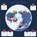
Arctic map with countries boundary, grid and label. Arctic regions of northern hemisphere. Circumpolar projection. Vector. Infographic. Blue background.


Stockphotos.ro (c) 2025. All stock photos are provided by Dreamstime and are copyrighted by their respective owners.