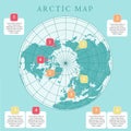
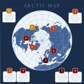
arctic map with countries boundary grid and label regions northern hemisphere circumpolar projection vector infogra |
||||||||||||||||||||||||||||||||||||||||
navigate by keyword : america and arctic asia australia background blank blue boundary capitals cartography circumpolar clearly color colorful contemporary continent countries country dark design detail detailed education element emblem flat geography global graphic green grey grid hemisphere illustration info infographic information label land layout legend major map north northern ocean planet political presentation projection regions scale similar simple small south symbol template topographic usa vector vintage west white world |
||||||||||||||||||||||||||||||||||||||||
|
||||||||||||||||||||||||||||||||||||||||
Arctic map with countries boundary, grid and label. Arctic regions of northern hemisphere. Circumpolar projection. Vector. Infographic. Blue background. |
||||||||||||||||||||||||||||||||||||||||
Stockphotos.ro (c) 2025. All stock photos are provided by Dreamstime and are copyrighted by their respective owners. |