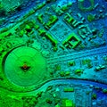
high resolution orthorectified orthorectification aerial map used for photogrammetry

navigate by keyword : aerial agua analysis area assisted banos borne celec cgi computer construction dam development digital drone ecuador efficient elevation engineer engineering geodesy georeferenced geospatial gis ground groundbreaking harvesting high hydrologic hydrological inspection investigation large map model modern multirotor orthorectification orthorectified photogrammetry potential professional representation resolution riverbed santa smart space spatial survey surveying technique technology terrain topology tungurahua visual water

High Resolution Orthorectified, Orthorectification Aerial Map Used For Photogrammetry Royalty Free Stock Photo
High Resolution Aerial Digital Elevation Model Royalty Free Stock Photo
   
   
High Resolution Orthorectified, Orthorectification Aerial Map Used For Photogrammetry


High Resolution Orthorectified, Orthorectification Aerial Map Used For Photogrammetry In Banos Ecuador


Stockphotos.ro (c) 2025. All stock photos are provided by Dreamstime and are copyrighted by their respective owners.