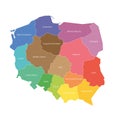
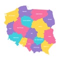
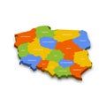
voivodeships poland map regional country administrative divisions colorful vector illustration |
||||||||||||||||||||||||||||||||||||||||
navigate by keyword : administrative area background black border cartography contour country county design divided division flat geography graphic greater illustration internal label lower lublin map masovia masuria modern name nation national opole outline part podlaskie poland pomerania province region regional shape silesia silhouette simple simplified state subcarpathia territory thin vector white |
||||||||||||||||||||||||||||||||||||||||
|
||||||||||||||||||||||||||||||||||||||||
Voivodeships of Poland. Map of regional country administrative divisions. Colorful vector illustration. |
||||||||||||||||||||||||||||||||||||||||
Stockphotos.ro (c) 2025. All stock photos are provided by Dreamstime and are copyrighted by their respective owners. |