vector map the portuguese archipelago azores atlantic ocean portugal

navigate by keyword : abstract airport archipelago atlantic autonomous azores background border cartography city coastline colorful corvo country county delgada design eastern europe faial ferry flag flores geographic geography graciosa graphic group horta illustration island madalena map maria ocean pico political ponta porto portugal portuguese province region santa scale terceira topography travel vector vila volcano

Administrative vector map of the Portuguese archipelago Azores in the Atlantic Ocean, Portugal Royalty Free Stock Photo
Vector map of the portuguese archipelago Azores in the Atlantic ocean, Portugal Royalty Free Stock Photo
Vector map of the portuguese archipelago Azores in the Atlantic ocean with flag, Portugal Royalty Free Stock Photo
Sao Miguel Island, Azores, Portugal, gray political map Royalty Free Stock Photo
Sao Miguel Island, Azores, Portugal, political map, The Green Island Royalty Free Stock Photo
   
   
Vector map of the portuguese archipelago Azores in the Atlantic ocean, Portugal
Portugal Map with Highlighted Regions Royalty Free Stock Photo
Road map of the Portuguese Azores island of Corvo Royalty Free Stock Photo


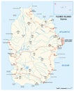
Roadap of the Portuguese Azores island of Flores Royalty Free Stock Photo
Vector map of the portuguese archipelago Azores in the Atlantic ocean, Portugal.


Stockphotos.ro (c) 2025. All stock photos are provided by Dreamstime and are copyrighted by their respective owners.