vector map the minneapolis saint paul metropolitan area minnesota united states

navigate by keyword : administrative america area atlas background border cartography cities city cloud communities counties county design destination drawing geography graphic guide illustration information isolated location map metropolitan minneapolis minneapolissaint minnesota mississippi municipality navigation orange outline paul place plan political region river saint states symbol topography town towns travel trip twin united usa vector

Vector map of the Minneapolis-Saint Paul metropolitan area, Minnesota, United States Royalty Free Stock Photo
Administrative map of the Metropolitan area Minneapolis-Saint Paul, Minnesota, Wisconsin, United States Royalty Free Stock Photo
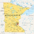
Minnesota, MN, political map, US state, nicknamed Land of 10,000 Lakes Royalty Free Stock Photo
Minnesota, MN, gray political map, US state, Land of 10,000 Lakes Royalty Free Stock Photo
Minneapolis on Minnesota State Map. Detailed MN State Map with Location Pin on Minneapolis City. Black silhouette vector map isola Royalty Free Stock Photo
   
   
Vector map of the Minneapolis-Saint Paul metropolitan area, Minnesota, United States
Wisconsin, WI, political map, US state, with the nickname Badger State Royalty Free Stock Photo


Vector map of the Minneapolis-Saint Paul metropolitan area, Minnesota, United States.


Stockphotos.ro (c) 2025. All stock photos are provided by Dreamstime and are copyrighted by their respective owners.