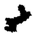
| vector map languedoc roussillon province france region silhouette | ||||||||||||||||||||||||||||||||||||||||
| navigate by keyword : administrative area atlas aude background black border cartography contour country county divisions europe european france french gard geography graphic herault icon illustration languedoc location lozere map mapping montpellier nation national outline paris political region republic roussillon shape silhouette state symbol territory travel tricolor trip vector world | ||||||||||||||||||||||||||||||||||||||||
| 
 | ||||||||||||||||||||||||||||||||||||||||
| Vector map Languedoc Roussillon province, France region. Languedoc Roussillon silhouette map illustration isolated on white background. French territory. | ||||||||||||||||||||||||||||||||||||||||
| Stockphotos.ro (c) 2025. All stock photos are provided by Dreamstime and are copyrighted by their respective owners. | ||||||||||||||||||||||||||||||||||||||||