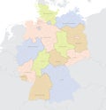
vector map germany with detailed administrative divisions and borders city region |
||||||||||||||||||||||||||||||||||||||||
navigate by keyword : administration administrative atlas background bavaria berlin border bordering borders brandenburg bremen bright capital cartography cities city colors continent countries country denmark detailed district divisions europe european flag geography german germany hamburg hesse illustration international land map mapadministrative mapping mapsticker mecklenburgvorpommern munich names nation national palette political region regions republic rhinelandpalatinate saarland sachsen saxony state territory thuringia travel vector world worldwide |
||||||||||||||||||||||||||||||||||||||||
|
||||||||||||||||||||||||||||||||||||||||
Vector Map of Germany with detailed Administrative divisions and borders, City and Region Names and international bordering countries in bright colors palette |
||||||||||||||||||||||||||||||||||||||||
Stockphotos.ro (c) 2025. All stock photos are provided by Dreamstime and are copyrighted by their respective owners. |