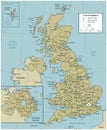
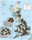
vector map the english channel between united kingdom and france |
||||||||||||||||||||||||||||||||||||||||
| navigate by keyword : atlantic atlas bay belgium brest britain canal cape cartography channel cherbourg city coastline cornwall county dover england english europe france geography great havre hydrographic irish island islands kingdom london malo map north ocean outline paris peninsula portsmouth river saint scale sea seine somme southampton strait travel tunnel united vector waterway wight |
||||||||||||||||||||||||||||||||||||||||
|
||||||||||||||||||||||||||||||||||||||||
| Vector map of the English Channel between United Kingdom and France. |
||||||||||||||||||||||||||||||||||||||||
|
Stockphotos.ro (c) 2025. All stock photos are provided by Dreamstime and are copyrighted by their respective owners. |
||||||||||||||||||||||||||||||||||||||||