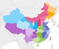
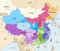
vector map china provinces colored regions with neighbouring countries and territories

navigate by keyword : administrative asia background beijing cartography china chinese chongqing colored countries country division east fujian geography guangdong guangxi guizhou heilongjiang hong hubei hunan illustration india jiangsu kong korea liaoning macau map municipality myanmar neighbouring nepal ningxia north political province provinces qinghai region regions russia shaanxi shandong shanghai shanxi sichuan south taiwan territories tianjin tibet vector vietnam xinjiang zhejiang

Vector map of China provinces colored by regions with neighbouring countries and territories Royalty Free Stock Photo


Vector map of China provinces colored by regions with neighbouring countries and territories


Vector map of China provinces colored by regions with neighbouring countries and territories.


Stockphotos.ro (c) 2025. All stock photos are provided by Dreamstime and are copyrighted by their respective owners.