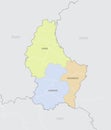
vector map belgium with flag the location country world and europe silhouette |
||||||||||||||||||||||||||||||||||||||||
navigate by keyword : administrative atlas belgium blue bruxelles capital cartography concept country element europa european federal flag geography government graphic icon illustration isolated land map modern nation national nationality outline patriotic peace political sign silhouette simplified state symbol territorial territory texture tourism travel union vector white world |
||||||||||||||||||||||||||||||||||||||||
|
||||||||||||||||||||||||||||||||||||||||
Vector map of Belgium with flag. The location of the country on the map of the world and Europe. A silhouette with detailed borders of the state and the location of the country's capital. |
||||||||||||||||||||||||||||||||||||||||
Stockphotos.ro (c) 2025. All stock photos are provided by Dreamstime and are copyrighted by their respective owners. |