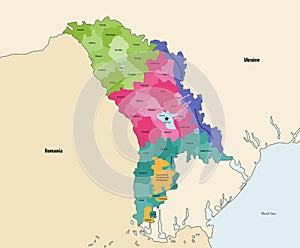
vector map administrative divisions moldova with neighbouring countries and territories |
||||||||||||||||||||||||||||||||||||||||
| navigate by keyword : administrative area art atlas background black border cahul cantemir cartography chi city concept contour countries country design district division divisions drochia europe floresti gaguzia geography graphic ialoveni illustration land leova map moldova national neighbouring nisporeni orhei political region romania sea silhouette singerei state straseni taracila territories territory transnistria travel ukraine vector world |
||||||||||||||||||||||||||||||||||||||||
|
||||||||||||||||||||||||||||||||||||||||
| Vector map of administrative divisions of Moldova with neighbouring countries and territories. |
||||||||||||||||||||||||||||||||||||||||
|
Stockphotos.ro (c) 2025. All stock photos are provided by Dreamstime and are copyrighted by their respective owners. |
||||||||||||||||||||||||||||||||||||||||