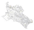
satellite map milan streets and building area number municipalities three italy |
||||||||||||||||||||||||||||||||||||||||
| navigate by keyword : aerial architecture area atlas background black border building buildings city country design destination district europe highway highways information isolated italy landmark lines lombardy map milan ministry municipalities nine number one outline ring rivers roads satellite sign signpost streets symbol three top touristic traffic transportation urban view white zone zones |
||||||||||||||||||||||||||||||||||||||||
|
||||||||||||||||||||||||||||||||||||||||
| Satellite map of Milan, streets and building of area number 3, municipalities number three. Lombardy. Italy |
||||||||||||||||||||||||||||||||||||||||
|
Stockphotos.ro (c) 2025. All stock photos are provided by Dreamstime and are copyrighted by their respective owners. |
||||||||||||||||||||||||||||||||||||||||