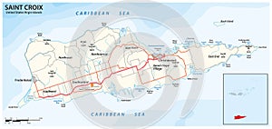
road map the caribbean island saint croix virgin islands united states

navigate by keyword : geography tourism topography virgin islands latin america political area territory icon terrain unincorporated county frederiksted christiansted scale hill peak beach caribbean sea coastline motorway road town city villige point cape bay infographic illustration united states island saint croix outline map border cartography vector travel mapping usa airport graphic

Road map of the caribbean island of Saint Croix, Virgin Islands, United States Royalty Free Stock Photo
Map of Saint Croix Island Royalty Free Stock Photo
Saint Croix map on road sign. Royalty Free Stock Photo
Virgin Islands political map Royalty Free Stock Photo
   
   
Road map of the caribbean island of Saint Croix, Virgin Islands, United States
Virgin islands map Royalty Free Stock Photo


Road map of the caribbean island of Saint Croix, Virgin Islands, United States.


Stockphotos.ro (c) 2025. All stock photos are provided by Dreamstime and are copyrighted by their respective owners.