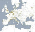
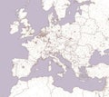
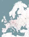
political map europe and africa european cities with the border states

navigate by keyword : africa algeria and areas border borders cities city countries cyprus denmark design divisions egypt england estonia europe european finland france germany greece holland iraq islands israel italy latvia lebanon libya lithuania luxembourg map mediterranean norway political russia sea spain states style sweden syria tunisia turkey ukraine urban vector

Political map of Europe and Africa. European cities. Political map with the border of the states Royalty Free Stock Photo
Street and political map of Europe and North Africa. European cities. Political map with the border of the states. Urban areas Royalty Free Stock Photo
Political map of Europe and Africa. European cities. Political map with the border of the states Royalty Free Stock Photo
Railway and political map of Europe and North Africa. European cities. Political map with the border of the states Royalty Free Stock Photo
Street and political map of Europe and North Africa. European cities. Political map with the border of the states. Urban areas. Royalty Free Stock Photo
   
   
Political map of Europe and Africa. European cities. Political map with the border of the states
Abstract multicolor vector design of political world map with capital cities name and border. Royalty Free Stock Photo


Political map of Europe and Africa. European cities. Political map with the border of the states. Urban areas


Stockphotos.ro (c) 2025. All stock photos are provided by Dreamstime and are copyrighted by their respective owners.