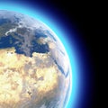
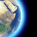
physical map the world satellite view south africa globe hemisphere reliefs and oceans |
||||||||||||||||||||||||||||||||||||||||
navigate by keyword : africa african art atlas background black border botswana cape cartography city contour country design detailed district durban earth free gauteng geography graphic isolated johannesburg land lesotho limpopo map mozambique mpumalanga namibia national physical political pretoria province rendering republic satellite shape silhouette south state symbol town travel view white world |
||||||||||||||||||||||||||||||||||||||||
|
||||||||||||||||||||||||||||||||||||||||
Physical map of the world, satellite view of South Africa. Globe. Hemisphere. Reliefs and oceans. 3d rendering. Element of this image are furnished by NASA |
||||||||||||||||||||||||||||||||||||||||
Stockphotos.ro (c) 2025. All stock photos are provided by Dreamstime and are copyrighted by their respective owners. |