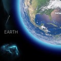
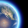
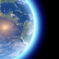
physical map the world satellite view central america globe hemisphere reliefs and oceans

navigate by keyword : administrative america american background belize border capital caribbean cartography central city colombia continent contour costa country cuba earth geography guatemala honduras illustration isolated jamaica land latin map mexico national nicaragua ocean outline pacific panama political region rendering rica salvador satellite sea silhouette south states symbol topography travel view white

Physical map of the world, satellite view of central America. Globe. Hemisphere. Reliefs and oceans Royalty Free Stock Photo
Physical map of the world, satellite view of north and central America. Globe. Hemisphere. Reliefs and oceans Royalty Free Stock Photo
Physical map of the world, satellite view of central America. Globe. Hemisphere. Reliefs and oceans Royalty Free Stock Photo
Physical map of the world, satellite view of North and central America. Globe. Hemisphere. Reliefs and oceans Royalty Free Stock Photo
Physical map of the world, satellite view of central America. Globe. Hemisphere. Reliefs and oceans Royalty Free Stock Photo
   
   
Physical map of the world, satellite view of central America. Globe. Hemisphere. Reliefs and oceans
Physical map of the world, satellite view of north America and Canada. Globe. Hemisphere. Night view, city lights Royalty Free Stock Photo


Physical map of the world, satellite view of central America. Globe. Hemisphere. Reliefs and oceans. 3d rendering. Elements of this image are furnished by NASA


Stockphotos.ro (c) 2024. All stock photos are provided by Dreamstime and are copyrighted by their respective owners.