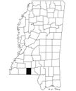
mississippi map state and district political with outline black white design

navigate by keyword : abstract america art background border cartography closeup concept contour country county design earth federal geography graphic illustration isolated jackson land location map mississippi national north outline pin place road route silhouette state states symbol tourism transport travel trip united usa vacation vector world

Mississippi Map. State and district map of Mississippi. Political map of Mississippi with outline and black and white design Royalty Free Stock Photo
Mississippi state outline administrative and political vector map in black and white Royalty Free Stock Photo
Indiana Map. State and district map of Indiana. Administrative and political map of Indiana with outline and black and white Royalty Free Stock Photo
outline Mississippi map with County in white on black background. Administrative map of Mississippi state, United State of America Royalty Free Stock Photo
Iowa Map. State and district map of Iowa. Political map of Iowa with outline and black and white design Royalty Free Stock Photo
Map of union County in Mississippi state on white background. single County map highlighted by black colour on Mississippi map. Royalty Free Stock Photo
Map of Yazoo County in Mississippi state on white background. single County map highlighted by black colour on Mississippi map. Royalty Free Stock Photo
Mississippi Map. State and district map of Mississippi. Political map of Mississippi with outline and black and white design
Map of Lee County in Mississippi state on white background. single County map highlighted by black colour on Mississippi map. Royalty Free Stock Photo
Map of clay County in Mississippi state on white background. single County map highlighted by black colour on Mississippi map. Royalty Free Stock Photo
Map of Jones County in Mississippi state on white background. single County map highlighted by black colour on Mississippi map. Royalty Free Stock Photo
Map of Smith County in Mississippi state on white background. single County map highlighted by black colour on Mississippi map. Royalty Free Stock Photo
Map of pike County in Mississippi state on white background. single County map highlighted by black colour on Mississippi map. Royalty Free Stock Photo
Map of Tate County in Mississippi state on white background. single County map highlighted by black colour on Mississippi map. Royalty Free Stock Photo
outline Mississippi map isolated on white background. Administrative map of Mississippi state, United State of America, US, United Royalty Free Stock Photo
Mississippi Map. State and district map of Mississippi. Political map of Mississippi with outline and black and white design design.


Stockphotos.ro (c) 2025. All stock photos are provided by Dreamstime and are copyrighted by their respective owners.