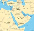
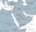
middle east political map countries with capitals and international borders |
||||||||||||||||||||||||||||||||||||||||
| navigate by keyword : sudan strait hormuz state political map persian gulf persia overview nation lebanon land iraq countries boundary geopolitical west asia syria mapping emirates sinai peninsula east levant western arabian middle eastern region atlas mediterranean sea egypt turkey europe africa arabia arab iran israel |
||||||||||||||||||||||||||||||||||||||||
|
||||||||||||||||||||||||||||||||||||||||
| Political map of the Middle East highlighting countries, capitals, and international borders. Ideal for educational, geopolitical, and informational purposes, offering a detailed view of the region's political landscape |
||||||||||||||||||||||||||||||||||||||||
|
Stockphotos.ro (c) 2025. All stock photos are provided by Dreamstime and are copyrighted by their respective owners. |
||||||||||||||||||||||||||||||||||||||||