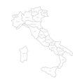
map italy divided into administrative regions white land black borders and labels simple flat vector

navigate by keyword : abruzzo abstract administrative apulia area art background black border calabria campania cartography colorful concept contour country detail europe geography illustration isolated italian italy land lazio liguria line lombardy map mediterranean nation national outline piedmont political provinces region regional rome sardinia shape sicily silhouette state surface travel tuscany vector veneto white

Map of Italy divided into 20 administrative regions. White land, black borders and black labels. Simple flat vector Royalty Free Stock Photo
Map of Italy divided into 20 administrative regions. Grey land, white borders and black labels. Simple flat vector Royalty Free Stock Photo


Map of Italy divided into 20 administrative regions. White land, black borders and black labels. Simple flat vector


Map of Italy divided into 20 administrative regions. White land, black borders and black labels. Simple flat vector illustration.


Stockphotos.ro (c) 2025. All stock photos are provided by Dreamstime and are copyrighted by their respective owners.