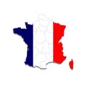
map france with the boundaries cities country vector illustration

navigate by keyword : backdrop background banner blank blue cartography cloth concept contour country design detailed empty europe fabric flag food frame france french geography graphic gray icon illustration isolated map national object paris people pole political republic round sea set sign silhouette symbol template textile travel vector waving white world

Map of France with the boundaries of the cities of the country. Vector illustration Royalty Free Stock Photo
Detailed editable vector map of France on Arab language Royalty Free Stock Photo
Detailed editable vector map of France on German language Royalty Free Stock Photo
Detailed editable vector map of France on French language Royalty Free Stock Photo
Detailed editable vector map of France on Spanish language Royalty Free Stock Photo
Detailed editable vector map of Egypt on Arab language Royalty Free Stock Photo
Detailed editable vector map of India on Hindi language Royalty Free Stock Photo
Map of France with the boundaries of the cities of the country. Vector illustration
Detailed editable vector map of France on Italian language Royalty Free Stock Photo
Detailed editable vector map of France on English language Royalty Free Stock Photo
Detailed editable vector map of Brazil, Brasilia on French language Royalty Free Stock Photo
Detailed editable vector map of Belarus on English language Royalty Free Stock Photo
Detailed editable vector map of Germany on English language Royalty Free Stock Photo
Detailed editable vector map of Croatia on German language Royalty Free Stock Photo
Detailed Map Of France - Vector Illustration Royalty Free Stock Photo
Map of France with the boundaries of the cities of the country. Vector illustration.


Stockphotos.ro (c) 2025. All stock photos are provided by Dreamstime and are copyrighted by their respective owners.