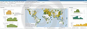
map displaying global data analysis with interactive points showing various statistics and information across continents

navigate by keyword : data analysis global statistics interactive map geographical information visualization points statistical continents countries analytics geographic representation trends mapping tools insights regional user interface demographics interpretation research distribution region visual chart technology exploration presentation hotspots correlation dashboard analytical overview patterns graphics spatial functionality features generated

Map Displaying Global Data Analysis With Interactive Points Showing Various Statistics and Information Across Continents Royalty Free Stock Photo
Global data visualization showing connections and statistics across continents and regions during nighttime. Generative Royalty Free Stock Photo


Map Displaying Global Data Analysis With Interactive Points Showing Various Statistics and Information Across Continents


A visual representation of global data with numerous markers indicating statistical information. AI generated


Stockphotos.ro (c) 2025. All stock photos are provided by Dreamstime and are copyrighted by their respective owners.