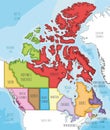
map the country canada with political divisions for infographics

navigate by keyword : text sketch presentation poster plan pattern organ map logo line font drawing diagram design circle cartoon brand branch canada geography infographic political division america art atlas black border canadian cartography city continent contour country detailed earth flat geographical globe graphic icon land location nation national north outline region shape sign silhouette state texture topography travel united usa vector white world

Map of the country of Canada with political divisions for infographics Royalty Free Stock Photo
Map of the country of Canada without political divisions for infographics Royalty Free Stock Photo
Detailed map of Canada administrative divisions with country flag and location on the globe. Royalty Free Stock Photo
Vector illustrated map of Canada with provinces and territories and administrative divisions, and neighbouring countries Royalty Free Stock Photo
Vector map of Canada with provinces and territories and administrative divisions. Royalty Free Stock Photo
Vector illustrated blank map of Canada with provinces and territories and administrative divisions, and neighbouring countries Royalty Free Stock Photo
Canada map, separate regions with names, infographics blue flat design Royalty Free Stock Photo
Map of the country of Canada with political divisions for infographics
Vector blank map of Canada with provinces and territories and administrative divisions, and neighbouring countries and territories Royalty Free Stock Photo
Vector blank map of Canada with provinces and territories and administrative divisions. Royalty Free Stock Photo
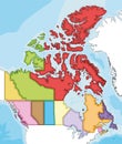
Vector map of Canada with provinces and territories and administrative divisions, and neighbouring countries and territories. Royalty Free Stock Photo
Canada Map Silhouette with Provinces and Territories - Black and White Vector Royalty Free Stock Photo
Vector blank map of Canada with provinces and territories and administrative divisions. Royalty Free Stock Photo
Vector map of Canada with provinces and territories and administrative divisions. Royalty Free Stock Photo
Canada map, individual regions with names, Infographics and icons Royalty Free Stock Photo
Map of the country of Canada with political divisions for infographics on white background


Stockphotos.ro (c) 2025. All stock photos are provided by Dreamstime and are copyrighted by their respective owners.