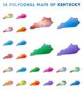
low poly map kentucky state usa polygonal shape vector illustration

navigate by keyword : america american atlas background border cartography concept conceptual contour design diagram framework geography geometric graphic grid illustration kentucky low lowpoly map maps mesh modern outline poly polygon polygonal shape state states technology territory text travel triangle type typography united usa vector white wireframe

Low Poly Map of Kentucky State USA. Polygonal Shape Vector Illustration Royalty Free Stock Photo
Low poly map of kentucky state. Vector illustration decorative design Royalty Free Stock Photo
Low poly map of Kentucky. Royalty Free Stock Photo
Kentucky - colorful low poly us state shape. Royalty Free Stock Photo
Iowa geometric map. Royalty Free Stock Photo
Kentucky icon. Royalty Free Stock Photo
Low Poly Map of Kentucky State USA. Polygonal Shape Vector Illustration
Polygonal map of Kentucky. Royalty Free Stock Photo
Kentucky geometric map. Royalty Free Stock Photo
Kentucky map design. Royalty Free Stock Photo
Kentucky\'s state map polygonal illustration made of lines and dots Royalty Free Stock Photo
Map of Kentucky. Royalty Free Stock Photo
Kentucky low poly sunburst set. Royalty Free Stock Photo
Set of vector polygonal maps of Kentucky. Royalty Free Stock Photo
Low Poly Map of Kentucky State USA. Polygonal Shape Vector Illustration on White Background. States of America Territory.


Stockphotos.ro (c) 2025. All stock photos are provided by Dreamstime and are copyrighted by their respective owners.