illinois map state and district administrative political with outline black white

navigate by keyword : abstract america art background blue card cartography chicago colorful community design downtown elements flat geographic geography geometric graphic illinois illustration isolated lake low map mockup mosaic neighborhood poly polygon polygonal region regional river rockford scheme solid springfield state states style texture town travel united urban usa vector visit

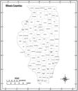
Illinois state outline administrative and political vector map in black and white Royalty Free Stock Photo
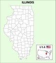
Illinois Map. State and district map of Illinois. Administrative and political map of Illinois with outline and black and white Royalty Free Stock Photo
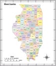
Illinois state outline administrative and political vector map in color Royalty Free Stock Photo
Map of St Clair County in Illinois state on white background. single County map highlighted by black colour on Illinois map. Royalty Free Stock Photo
Map of campaign County in Illinois state on white background. single County map highlighted by black colour on Illinois map. Royalty Free Stock Photo
Map of Franklin County in Illinois state on white background. single County map highlighted by black colour on Illinois map. Royalty Free Stock Photo
Map of Crawford County in Illinois state on white background. single County map highlighted by black colour on Illinois map. Royalty Free Stock Photo
Illinois Map. State and district map of Illinois. Administrative and political map of Illinois with outline and black and white
Map of sangamon County in Illinois state on white background. single County map highlighted by black colour on Illinois map. Royalty Free Stock Photo
Map of Woodford County in Illinois state on white background. single County map highlighted by black colour on Illinois map. Royalty Free Stock Photo
Map of tazewell County in Illinois state on white background. single County map highlighted by black colour on Illinois map. Royalty Free Stock Photo
Map of Lawrence County in Illinois state on white background. single County map highlighted by black colour on Illinois map. Royalty Free Stock Photo
Map of Iroquois County in Illinois state on white background. single County map highlighted by black colour on Illinois map. Royalty Free Stock Photo
Map of moultrie County in Illinois state on white background. single County map highlighted by black colour on Illinois map. Royalty Free Stock Photo
Map of macoupin County in Illinois state on white background. single County map highlighted by black colour on Illinois map. Royalty Free Stock Photo
Illinois Map. State and district map of Illinois. Administrative and political map of Illinois with outline and black and white design m


Stockphotos.ro (c) 2025. All stock photos are provided by Dreamstime and are copyrighted by their respective owners.