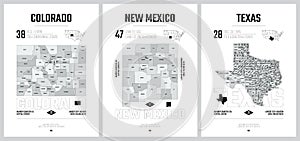
highly detailed vector silhouettes state maps division united states into counties political and geographic subdivisions |
||||||||||||||||||||||||||||||||||||||||
navigate by keyword : administrative aerial albuquerque america antonio austin border borough cartography central city colorado contour counties county cut dallas denver detailed district division federal fort geography high houston land local map mexico mountain nation new outline plan politics postage poster region san separated silhouette south stamp state states texas travel united usa vector view west world worth |
||||||||||||||||||||||||||||||||||||||||
|
||||||||||||||||||||||||||||||||||||||||
Highly detailed vector silhouettes of US state maps, Division United States into counties, political and geographic subdivisions of a states, Mountain and West South Central - Colorado, New Mexico, Texas - set 13 of 17 for design |
||||||||||||||||||||||||||||||||||||||||
Stockphotos.ro (c) 2025. All stock photos are provided by Dreamstime and are copyrighted by their respective owners. |