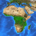
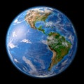
high resolution world map and landforms detailed satellite view the earth its |
||||||||||||||||||||||||||||||||||||||||
navigate by keyword : world map landforms satellite view earth detailed high resolution geography continents oceans terrain landscape aerial topography nature exploration cartography global science environment geology ecology planet naturalfeatures mapping imagery landmass visuals data analytics space education resources navigation travel analysis observation technology digital |
||||||||||||||||||||||||||||||||||||||||
|
||||||||||||||||||||||||||||||||||||||||
high-resolution satellite view of the earth, showcasing detailed landforms and geographic features. |
||||||||||||||||||||||||||||||||||||||||
Stockphotos.ro (c) 2025. All stock photos are provided by Dreamstime and are copyrighted by their respective owners. |