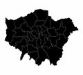
greater london map vector silhouette illustration isolated white background

navigate by keyword : administrative area border boroughs britain capital cartography center chelsea city county detailed district division england europe european geography government graphic great greater london map greenwich guide host kingdom mapping outline plan political region royal shadow shape silhouette thames tourism tower town travel union united vector

Greater London black vector silhouette map isolated on white background Royalty Free Stock Photo
Greater London map line contour vector silhouette illustration isolated on white background. Royalty Free Stock Photo
Greater London map vector silhouette illustration isolated on white background. Royalty Free Stock Photo
Greater London vector silhouette map. Royalty Free Stock Photo
London, United Kingdom. Detailed Country Map with Location Pin on Capital Cit Royalty Free Stock Photo
Detailed accurate map of London in high resolution Royalty Free Stock Photo
London map flag of main town in United Kingdom and in England country Royalty Free Stock Photo
Greater London map vector silhouette illustration isolated on white background.
Greater London silhouette map Royalty Free Stock Photo
Greater London County map England region Royalty Free Stock Photo
London map flag of main town in United Kingdom and in England country Royalty Free Stock Photo
Greater London silhouette map Royalty Free Stock Photo
Greater London County map England region Royalty Free Stock Photo
Greater London map vector silhouette illustration isolated on white background. London map of main town in United Kingdom, England country. London map shape shadow, UK.


Stockphotos.ro (c) 2025. All stock photos are provided by Dreamstime and are copyrighted by their respective owners.