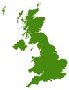
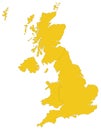
great britain map large island the north atlantic ocean northwest coast continental europe |
||||||||||||||||||||||||||||||||||||||||
navigate by keyword : atlantic britain cartography coast contour country europe file geography great illustration island kingdom large london map nation north northwest ocean region scotland silhouette state territory travel united vector wales |
||||||||||||||||||||||||||||||||||||||||
|
||||||||||||||||||||||||||||||||||||||||
Vector file of Great Britain map - large island in the north Atlantic Ocean of the northwest coast of continental Europe |
||||||||||||||||||||||||||||||||||||||||
Stockphotos.ro (c) 2025. All stock photos are provided by Dreamstime and are copyrighted by their respective owners. |