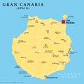
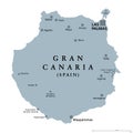
gran canaria grand canary island political map with capital las palmas |
||||||||||||||||||||||||||||||||||||||||
navigate by keyword : africa archipelago arucas atlantic atlas canaria canary capital cartography city country cruise destination english europe european geography gran grand holiday illustration infographic ingenio island islands labeling las map mapping maspalomas mediterranean nieves ocean overview palmas pico political sea spain telde tourism travel vector |
||||||||||||||||||||||||||||||||||||||||
|
||||||||||||||||||||||||||||||||||||||||
Gran Canaria political map with capital Las Palmas and important towns. Grand Canary Island, part of Spain, the second most populous Island of Canary Islands, off the Atlantic coast of Africa. Vector. |
||||||||||||||||||||||||||||||||||||||||
Stockphotos.ro (c) 2025. All stock photos are provided by Dreamstime and are copyrighted by their respective owners. |