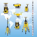
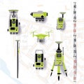
geodesy equipment vector illustration measuring instruments flat design theodolite tacheometer total station drone level

navigate by keyword : background blue cadaster cartography construction controller coordinate design drone ecological elevation engineering equipment estimate exploration field flat geodesy geodetic geological geology globe gravitation gyro illustration instruments inventory isolated land laser latitude level leveling longitude map mapping measurement measuring mining photogrammetry pole projection research resources satellite sketch sputnik station survey surveying tacheometer terrain theodolite topographic total vector world

Geodesy equipment vector illustration. Measuring instruments in flat design. Theodolite, tacheometer, total station, drone, level Royalty Free Stock Photo


Geodesy equipment vector illustration. Measuring instruments in flat design. Theodolite, tacheometer, total station, drone, level


Geodetic equipment vector illustration. Measuring instruments in flat design. Theodolite, tacheometer, total station, drone, level, map sketch isolated on world map blue background


Stockphotos.ro (c) 2025. All stock photos are provided by Dreamstime and are copyrighted by their respective owners.