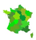
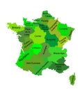
france region comte map vector silhouette illustration isolated white background | 
	||||||||||||||||||||||||||||||||||||||||
| navigate by keyword : administrative area areas atlas background belfort besancon border burgundy cartography comte country county dole earth europe france franche french geography graphic icon illustration information isolated lons map montbeliard nation national outline political pontarlier provence province region saunier shape sign silhouette state symbol territory travel trip vector vesoul web white		 | 
	||||||||||||||||||||||||||||||||||||||||
			
			
  | 
	||||||||||||||||||||||||||||||||||||||||
| France region Comte map vector silhouette illustration isolated on white background. French Comte map. France territory. | 
	||||||||||||||||||||||||||||||||||||||||
| 
 Stockphotos.ro (c) 2025. All stock photos are provided by Dreamstime and are copyrighted by their respective owners.  | 
	||||||||||||||||||||||||||||||||||||||||