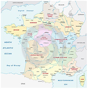
france map with the new regions and most important cities rivers |
||||||||||||||||||||||||||||||||||||||||
navigate by keyword : administration administrative atlantic background belgium biscaya black border cartography channel cities city color colorful country department design english france french geography germany graphic illustration important italy kingdom luxembourg map mapping mediterranean monaco most national new ocean outline paris political region regional regions rivers sea simple switzerland territory tourism travel united vector with |
||||||||||||||||||||||||||||||||||||||||
|
||||||||||||||||||||||||||||||||||||||||
France map with the new regions and the most important cities and rivers. |
||||||||||||||||||||||||||||||||||||||||
Stockphotos.ro (c) 2025. All stock photos are provided by Dreamstime and are copyrighted by their respective owners. |