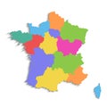
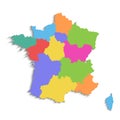
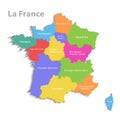
france map new political detailed separate individual regions with state names isolated white background |
||||||||||||||||||||||||||||||||||||||||
navigate by keyword : administrative alpes atlas background blue bourgogne brittany color colored colorful colors continent contour corse country detailed earth est europe european france french gallic geography grand green guernsey individual island isolated jersey loire map names new normandy occitania orange outline political provence province purple region regions republic separate state travel union val vector violet wall white world yellow |
||||||||||||||||||||||||||||||||||||||||
|
||||||||||||||||||||||||||||||||||||||||
France map, new political detailed map, separate individual regions, with state names, isolated on white background 3D vector |
||||||||||||||||||||||||||||||||||||||||
Stockphotos.ro (c) 2025. All stock photos are provided by Dreamstime and are copyrighted by their respective owners. |