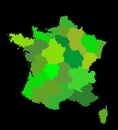
editable blank vector map france silhouette illustration isolated black background |
||||||||||||||||||||||||||||||||||||||||
navigate by keyword : alpes alps alsace aquitaine ardennes atlas auvergne azur border brittany burgundy calais cartography center champagne chart corsica country destination divisions europe france french geography green illustration limousin loire lorraine lower map mapping national normandy north outline paris pays provence region republic rhone silhouette state symbol tourism travel tricolor trip vector |
||||||||||||||||||||||||||||||||||||||||
|
||||||||||||||||||||||||||||||||||||||||
Editable blank vector map of France vector silhouette illustration isolated on black background. Autonomous communities of French regions, administrative divisions, separated province outline map. |
||||||||||||||||||||||||||||||||||||||||
Stockphotos.ro (c) 2025. All stock photos are provided by Dreamstime and are copyrighted by their respective owners. |