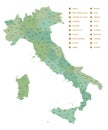
detailed vector blue map italy white background with administrative divisions into regions the country

navigate by keyword : administrative area atlas background blue border business cartography chart city contour country europa flag florence geography globe graphic icon illustration islands isolated italian italy land line lmediterranean lombardi map milan naples national outline pisa political province regions rome sardinia sea sicily silhouette simplified symbol template transport travel vector venice world

Detailed, vector, blue map of Italy on white background with administrative divisions into regions of the country Royalty Free Stock Photo
Detailed map of Italy with administrative divisions into regions and provinces of the country, vector illustration on white Royalty Free Stock Photo
Italy map. Detailed blue outline and silhouette. Administrative divisions and regions. Country flag. Set of vector maps. All isola Royalty Free Stock Photo
Italy map vector. High detailed vector outline, blue silhouette and administrative divisions, regions. All isolated on white backg Royalty Free Stock Photo
Detailed monochrome map of Italy, gray country territory with geographic borders and administrative divisions on white background Royalty Free Stock Photo
   
   
Detailed, vector, blue map of Italy on white background with administrative divisions into regions of the country
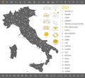
Italy - detailed blue country map with cities, regions, location on world map and globe. Infographic icons Royalty Free Stock Photo
Highly Detailed Map of Western Europe with Regions and Countries Illustrated Royalty Free Stock Photo


Highly Detailed Map of Western Europe with Regions and Countries Illustrated Royalty Free Stock Photo
Italy vector set. Royalty Free Stock Photo
Detailed, vector, blue map of Italy on white background with administrative divisions into regions of the country, for your design


Stockphotos.ro (c) 2025. All stock photos are provided by Dreamstime and are copyrighted by their respective owners.