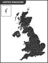
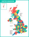
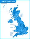
the detailed map united kingdom with regions states actual current relevant great britain administrative devision |
||||||||||||||||||||||||||||||||||||||||
navigate by keyword : administrative atlas backdrop background border britain british cartography chart concept continent contour country county detail devision england english europe european geography great icon ireland island isles isolated kindom kingdom land london map nation national north northern patriotic region scotland silhouette state travel union united vector wales world |
||||||||||||||||||||||||||||||||||||||||
|
||||||||||||||||||||||||||||||||||||||||
The detailed map of the United Kingdom with regions or states. Actual current relevant UK, Great Britain administrative devision.. Vector illustration |
||||||||||||||||||||||||||||||||||||||||
Stockphotos.ro (c) 2025. All stock photos are provided by Dreamstime and are copyrighted by their respective owners. |