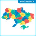
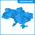
the detailed map ukraine with regions states and cities capital administrative division crimea part donetsk |
||||||||||||||||||||||||||||||||||||||||
| navigate by keyword : administrative border boundary capital cartography chart chernobyl city contour country county crimea detailed district dnipro donetsk earth eastern europe european flag geography graphic icon isolated kharkiv kiev kyiv land luhansk lviv map nation national oblast odessa outline peninsula political province region republic sevastopol shape silhouette territory travel ukraine ukrainian vector |
||||||||||||||||||||||||||||||||||||||||
|
||||||||||||||||||||||||||||||||||||||||
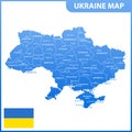
| The detailed map of the Ukraine with regions or states and cities, capital. Administrative division. Crimea, part of Donetsk and Lugansk regions is marked as a disputed territory. Vector Illustration |
||||||||||||||||||||||||||||||||||||||||
|
Stockphotos.ro (c) 2025. All stock photos are provided by Dreamstime and are copyrighted by their respective owners. |
||||||||||||||||||||||||||||||||||||||||