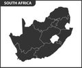
the detailed map south africa with regions states administrative division |
||||||||||||||||||||||||||||||||||||||||
| navigate by keyword : administrative africa african atlas background border business cape capital cartography city contour country cut detailed district division durban education free gauteng geographic geography graphic icon illustration isolated johannesburg land limpopo map mpumalanga national outline political politics pretoria province region regions republic shape silhouette south state states template territory town travel vector |
||||||||||||||||||||||||||||||||||||||||
|
||||||||||||||||||||||||||||||||||||||||
| The detailed map of South Africa with regions or states. Administrative division. Vector illustration |
||||||||||||||||||||||||||||||||||||||||
|
Stockphotos.ro (c) 2025. All stock photos are provided by Dreamstime and are copyrighted by their respective owners. |
||||||||||||||||||||||||||||||||||||||||