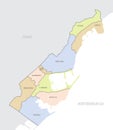
detailed map monaco with administrative divisions the country color vector illustration |
||||||||||||||||||||||||||||||||||||||||
navigate by keyword : abstract administrative background border carlo cartography city citystate color concept condamine country design detailed district divisions eps europe flag fontvieille france french geography globe graphic icon illustration isolated land larvotto ligurian map mediterranean michel monaco monacoville monarchy monte municipalities outline political port principality riviera rousse saint sea silhouette south symbol tourism travel typography vector ward world your |
||||||||||||||||||||||||||||||||||||||||
|
||||||||||||||||||||||||||||||||||||||||
Detailed map of Monaco with administrative divisions of the country, color vector illustration, for your design |
||||||||||||||||||||||||||||||||||||||||
Stockphotos.ro (c) 2025. All stock photos are provided by Dreamstime and are copyrighted by their respective owners. |