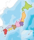
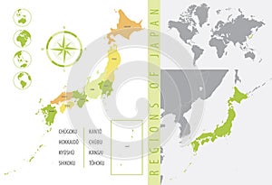
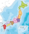
detailed map japan with administrative divisions the country color vector illustration |
||||||||||||||||||||||||||||||||||||||||
| navigate by keyword : administrative aichi asia atlas border cartography china chubu chugoku city color communication concept continent country design detailed district divisions flag fukuoka fukushima geography globe gunma hokkaido hyogo ibaraki icon illustration infographic islands japan kagoshima kanagawa kansai kanto kyoto kyushu map okinawa osaka prefecture province region sapporo sea shikoku tohoku tokio travel vector world yokohama your |
||||||||||||||||||||||||||||||||||||||||
|
||||||||||||||||||||||||||||||||||||||||
| Detailed map of Japan with administrative divisions of the country, color vector illustration, for your design |
||||||||||||||||||||||||||||||||||||||||
|
Stockphotos.ro (c) 2025. All stock photos are provided by Dreamstime and are copyrighted by their respective owners. |
||||||||||||||||||||||||||||||||||||||||