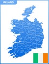
the detailed map ireland with regions states and cities capitals national flag

navigate by keyword : administrative and atlas border boundary capital capitals cartography chart cities continent cork country detailed district donegal drawing dublin earth education europe european flag galway geography global high icon illustration international ireland irish island kildare land limerick map meath nation national north offaly political province region regions republic state states territory topography travel union vector waterford world

The detailed map of the Ireland with regions or states and cities, capitals, national flag Royalty Free Stock Photo
The detailed map of the United Kingdom with regions or states and cities, capitals. Actual current relevant UK, Great Britain admi Royalty Free Stock Photo


The detailed map of the Ireland with regions or states and cities, capitals, national flag


The detailed map of the Ireland with regions or states and cities, capitals, national flag. Vector illustration


Stockphotos.ro (c) 2025. All stock photos are provided by Dreamstime and are copyrighted by their respective owners.