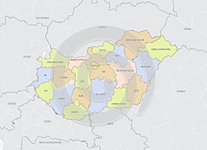
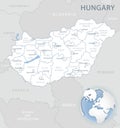
detailed location map hungary europe with administrative divisions the country vector illustration |
||||||||||||||||||||||||||||||||||||||||
navigate by keyword : administrative area atlas background baranyan blue border budapest cartography central city country county debrecen design detailed districts divisions europa europe flag geography globe heves hungary icon illustration isolated kecskemacopy krai land location map national oblast pacopy political province regions sea silhouette state symbol szekesfehervar territory tolna topographic travel vector veszprem vienghriia western your zones |
||||||||||||||||||||||||||||||||||||||||
|
||||||||||||||||||||||||||||||||||||||||
Detailed location map of Hungary in Europe with administrative divisions of the country, vector illustration, for your design |
||||||||||||||||||||||||||||||||||||||||
Stockphotos.ro (c) 2025. All stock photos are provided by Dreamstime and are copyrighted by their respective owners. |