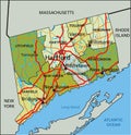
detailed editable political map with separated layers connecticut

navigate by keyword : administrative american atlantic atlas background bridgeport capital cartography city colored connecticut constitution continent contour country county district editable geographic geography green hartford interstate label land lime map mapping north nutmeg ocean olive outline pastel political politics region rivers road shade shape state territory topography travel united states america usa vector

Detailed editable political map with separated layers. Connecticut Royalty Free Stock Photo


Detailed editable political map with separated layers. Connecticut


Highly detailed editable political map with separated layers. Connecticut


Stockphotos.ro (c) 2025. All stock photos are provided by Dreamstime and are copyrighted by their respective owners.