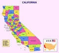
california map state and district administrative political with names color design |
||||||||||||||||||||||||||||||||||||||||
| navigate by keyword : administrative america american area art background barbara blue border california cartography cartoon contour county detailed district element famous fredericton geography gray grey guide illustration isolated isometric line location locator map mapping north outline overview people poster print region santa silhouette state texture tourism town travel tree urban usa vector |
||||||||||||||||||||||||||||||||||||||||
|
||||||||||||||||||||||||||||||||||||||||
| California Map. State and district map of California. Administrative and political map of California with names and color |
||||||||||||||||||||||||||||||||||||||||
|
Stockphotos.ro (c) 2025. All stock photos are provided by Dreamstime and are copyrighted by their respective owners. |
||||||||||||||||||||||||||||||||||||||||