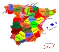
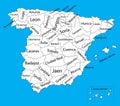
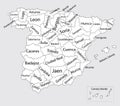
blue map spain and the islands with administrative divisions into autonomous communities vector illustration |
||||||||||||||||||||||||||||||||||||||||
navigate by keyword : administrative and andalusia area asturias atlas autonomous autonomy balearic barcelona basque blue border burgos canary canneries cartography castile castilela catalonia ceuta city community country division europa flag geography gibraltar globe icon illustration international islands leon madrid malaga mancha map melilla ocean political province provinces sea seville spain spanish tenerife tourism travel valencia vector world |
||||||||||||||||||||||||||||||||||||||||
|
||||||||||||||||||||||||||||||||||||||||
Blue map of Spain and the islands, with administrative divisions into autonomous communities and islands, vector illustration on a white background, for your design |
||||||||||||||||||||||||||||||||||||||||
Stockphotos.ro (c) 2025. All stock photos are provided by Dreamstime and are copyrighted by their respective owners. |