blue colored united kingdom outline map political vector illustration

navigate by keyword : abstract background border britain british cartography contour country democratic design edinburgh england english europe european flat geography glasgow graphic great icon illustration individual ireland isolated kingdom land liverpool location london manchester map northern organization outline politic political region scotland shape silhouette silhouettes state states symbol travel united vector wales white with world

Blue colored United Kingdom outline map. Political uk map. Vector illustration Royalty Free Stock Photo
United Kingdom - Highly detailed editable political map with separated layers. Royalty Free Stock Photo
Highly detailed editable political map with separated layers. United Kingdom. Royalty Free Stock Photo
United Kingdom - Highly detailed editable political map with separated layers. Royalty Free Stock Photo
   
   
Blue colored United Kingdom outline map. Political uk map. Vector illustration
Highly detailed editable political map with separated layers. United Kingdom. Royalty Free Stock Photo
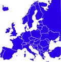
Blue colored European states map. Political europe map Royalty Free Stock Photo
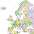
Political Map of Europe showing European Countries and Territories Royalty Free Stock Photo
Map of Europe divided into states and provinces. European political map Royalty Free Stock Photo
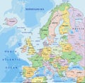
Europe - Highly detailed editable political map with separated layers. Royalty Free Stock Photo
Blue colored political maps of UK isolated on white backgroundblue colored political maps of United Arba Emirates isolated onb Royalty Free Stock Photo
Blue colored United Kingdom outline map. Political uk map. Vector illustration map


Stockphotos.ro (c) 2025. All stock photos are provided by Dreamstime and are copyrighted by their respective owners.