blank political north america map vector illustration with countries white color

navigate by keyword : blank north america canada mexico greenland continent world detailed map cartoon colorful color sea ocean graphic illustration isolated geography flat modern vector travel planet education earth cartography art white blue land country borders background design global mockup atlas shape topography info infographics information political

Blank Political North America Map vector illustration with countries in white color. Royalty Free Stock Photo
Blank Political America Map vector illustration with countries in white color. Royalty Free Stock Photo
Multi-colored blank political vector map of World with national borders of countries on white background Royalty Free Stock Photo
Vector blank map of USA with states and administrative divisions, and neighbouring countries. Royalty Free Stock Photo
Vector blank map of Mexico with regions or states and administrative divisions, and neighbouring countries. Royalty Free Stock Photo
Pacific Centred World Colored Map Isolated on white. No text Royalty Free Stock Photo
Arctic map with countries boundary, grid and label. Arctic regions of northern hemisphere. Circumpolar projection. Vector. Infogra Royalty Free Stock Photo
Blank Political North America Map vector illustration with countries in white color.
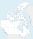
Vector blank map of Canada with provinces and territories and administrative divisions, and neighbouring countries and territories Royalty Free Stock Photo
Vector illustrated blank map of Mexico with regions or states and administrative divisions, and neighbouring countries. Royalty Free Stock Photo
Vector map of world in grey with white borders Royalty Free Stock Photo
Bright colorful political map in isometry with the names of countries, each continent in different color Royalty Free Stock Photo
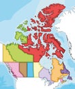
Vector illustrated blank map of Canada with provinces and territories and administrative divisions, and neighbouring countries Royalty Free Stock Photo
Vector illustrated blank map of USA with states and administrative divisions, and neighbouring countries. Royalty Free Stock Photo
Detailed vector World Map with Countries and borders Royalty Free Stock Photo
Blank Political North America Map vector illustration with countries in white color. Editable and clearly labeled layers


Stockphotos.ro (c) 2025. All stock photos are provided by Dreamstime and are copyrighted by their respective owners.